Export Profile Image Command
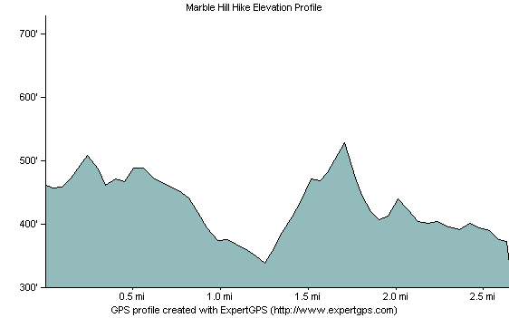
Use the Export Profile Image command to create an elevation profile image that you can post on your Web site, or use in a presentation.

To create an image of the elevation profile, do the following:
- View an elevation profile.
- Click the .
The Export Profile Image dialog will appear, allowing you to customize how the image will appear. Click to save the image.

- Header
- To add a title to your image, check Header and enter a title.
- Footer
- To add text below the elevation profile, check Footer and enter the text to display.
- Resize
- To specify the size of the image, select Resize, and enter a width and height. If Resize is not checked, the elevation profile image will be the same size as the elevation profile window in ExpertGPS.
- Width
- Enter the width of the resized image.
- Height
- Enter the height of the resized image.
ExpertGPS works with hundreds of GPS receivers, including all
Garmin Drive,
nüvi,
eTrex,
Colorado,
Dakota,
echoMAP,
GPSMAP,
Edge,
Forerunner,
Montana,
Oregon, and
Rino models,
Magellan eXplorist GPS receivers, and
Lowrance HDS,
Elite, and
HOOK GPS chartplotters and fishfinders.
Download ExpertGPS
Find your GPS on the ExpertGPS compatibility list.
© 1998-2024 TopoGrafix – 24 Kirkland Dr, Stow, MA – Email: support@expertgps.com


