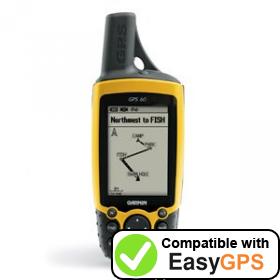
Download free GPS software for your Garmin GPS 60 GPS!

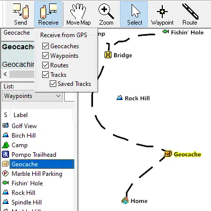
EasyGPS is the free, easy way to upload and download waypoints, routes, and tracks between your Garmin GPS 60 GPS and your Windows computer or laptop. Backup your favorite Garmin POIs, create and send new waypoints and geocaches to your GPS, or print a map of your GPS tracklog. To get started, download your free copy of EasyGPS.
New features were added to EasyGPS 9.13 on March 20, 2025
Here are some of our favorite tips to get the most out of your Garmin GPS 60 GPS with EasyGPS and ExpertGPS, our full-featured mapping software:
If you're a geocacher, EasyGPS lets you download geocaching GPX and LOC files directly to your Garmin GPS 60.
EasyGPS calculates the area of any Garmin GPS track or route, making it a perfect tool for calculating acreage on your farm, ranch, or business. Read our tutorials on using EasyGPS and ExpertGPS to calculate area.
Geotag your photos so everyone can see exactly where you took them. EasyGPS automatically geotags photos from any digital camera, allowing you to map them on flickr.com and in Google Earth.
Convert any coordinate format and datum. EasyGPS converts between lat/lon, UTM, MGRS, and hundreds of national grid coordinate formats. Just one click converts all of your Garmin data between any format or datum (WGS84, NAD27, NAD83, and dozens more).
Backup your Garmin GPS 60 GPS waypoints, routes, and tracks after each outing, so your GPS data is always safe on your computer. Many EasyGPS users clear the memory in their Garmin each time after backing up in EasyGPS. This gives them the maximum data storage for recording waypoints and tracklogs on their next adventure.
View your GPS waypoints and tracks in Google Earth. You can view all of your EasyGPS data in Google Earth. For the ultimate experience, including the ability to send Google Earth data and KML files to your Garmin GPS, check out the one-click Google Earth integration in ExpertGPS.
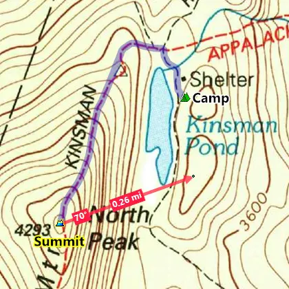
ExpertGPS also lets you view your GPS data over topo maps, aerial photos, and your own scanned trail maps. If you're serious about getting the most out of your GPS, check out the free trial of ExpertGPS, the ultimate mapping software download for your Garmin GPS 60 GPS.
Get the world's #1 free GPS software...
- EasyGPS is 100% FREE software! No ads or spyware
- Download geocaches to your GPS
- Backup and print out your waypoints and tracks
...or test drive the power of ExpertGPS
- ExpertGPS adds street maps, topos, and aerial photos!
- Convert and reproject your GPS, CAD, and GIS data
- View your GPS tracks and data in Google Earth
© 1998-2025 TopoGrafix – 24 Kirkland Dr, Stow, MA, USA
Get Help & Support for EasyGPS
Try ExpertGPS: Advanced Geocaching and Mapping Software with Topo Maps and Aerial Photos

